This one mile trail offers two alternative routes to reach a small waterfall on Cascade Creek. To reach the trailhead parking lot, go 7 miles northeast of Bergland on Forest Road 400 to the junction with Forest Road 468. Two routes depart from the parking lot. The scenic Twin Peaks route climbs a bluff overlooking the West Branch of the Ontonagon River and the Trap Hills. The Valley route avoids the steep path of the higher route but reaches the same destination.
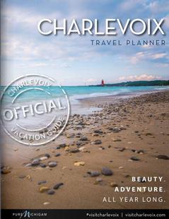
Northern MichiganBeaches, outdoor concerts, art fairs, championship golf, "fresh pick" orchards and incomparable water sports in the summer; unmatched Fall colors;cross-country skiing, snowshoeing and snowmobiling in the Winter. Charlevoix is a year-round lifetime's - vacation community. Request this Free Visitor GuideRequested!You're all set! Complete the form below to receive your guides by mail.
We also have the following visitor guides in Michigan. Click on any additional guides you would like to receive.
Charlevoix Northern Michigan
Charlevoix
Northern MichiganBeaches, outdoor concerts, art fairs, championship golf, "fresh pick" orchards and incomparable water sports in the summer; unmatched Fall colors;cross-country skiing, snowshoeing and snowmobiling in the Winter. Charlevoix is a year-round lifetime's - vacation community. Request this Free Visitor GuideRequested!You're all set! Complete the form below to receive your guides by mail.
We also have visitor guides available in states highlighted in blue below. Click on any state to see what's available.
Alaska
Arizona
California
Canada
Colorado
Hawaii
Idaho
Louisiana
Michigan
Montana
Nevada
New Mexico
Ohio
Oregon
Texas
Utah
Washington
Wyoming
Switch to Mobile Browser Mode
We offer a compact version of Go-Michigan for mobile users, allowing you to access just the information you need on the road. Of course, you can still use the full version of Go-Michigan on your mobile device just as you can on your desktop.