


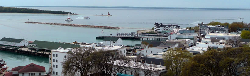


Arriving on Mackinac Island is like stepping back in time. A preserved Victorian era setting, where horse and buggy is still the norm, the island is home to only 500-600 year round residents. Roughly 80 percent of the island is a state park, and noted by National Geographic as one of the top ten state parks in the country.
The downtown district consists of four blocks of shopping and restaurants, including the fudge shops legendary to the island. Mackinac Island prohibits cars, so visitors must travel either by foot or bicycle or by horse and buggy. There are carriage tours available for tourists offering glimpses of both the notable sights on the island like the Grand Hotel, and Fort Mackinac.
Mackinac Island State Park consists of 1,800 acres of land, covering most of the island. Victorian cottages line the outer bluffs, and Fort Mackinac-- the former military outpost, including officers' quarters, the hospital and barracks is the most notable attraction at the park. There are around 70 miles of trails to explore via foot or bicycle within the park, and rock formations like Arch Rock and Sugarloaf are popular sites as well.
Mackinac Island is located just east of St. Ignace on Lake Huron. It is northeast of Mackinaw City, between the Lower and Upper Peninsulas of Michigan.


