An interesting side trip from the Bergland portion of the North Country Trail is the Gogebic Ridge Trail. It begins from a point along Forest Road 250, one mile north of M-28 at Merriweather, or on M-64, 3 miles north of Bergland. The trail leads east from Forest Road 250 along the north and east shore of Weary Lake to a ledge overlooking Lake Gogebic, and then northward where it intersects M-64. The trail crosses M-64 and continues east over Cookout Mountain to Old M-64. After crossing Old M-64, the trail leads to Sandhill Creek, and finally ends at its junction with the North Country Trail.
Northern MichiganBeaches, outdoor concerts, art fairs, championship golf, "fresh pick" orchards and incomparable water sports in the summer; unmatched Fall colors;cross-country skiing, snowshoeing and snowmobiling in the Winter. Charlevoix is a year-round lifetime's - vacation community. Request this Free Visitor GuideRequested!You're all set! Request a few more Visitor Guides, or complete the form below to receive your guides by mail.
Petoskey Area - Northern Michigan Northern Michigan
Petoskey Area - Northern Michigan
Northern MichiganWelcome to the Petoskey Area - the Land of More and the epitome of Summer in Northern Michigan. Request this Free Visitor GuideRequested!You're all set! Request a few more Visitor Guides, or complete the form below to receive your guides by mail.
We also have the following visitor guides in Michigan. Click on any additional guides you would like to receive.
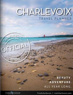
Charlevoix Northern Michigan
Charlevoix
Northern MichiganBeaches, outdoor concerts, art fairs, championship golf, "fresh pick" orchards and incomparable water sports in the summer; unmatched Fall colors;cross-country skiing, snowshoeing and snowmobiling in the Winter. Charlevoix is a year-round lifetime's - vacation community. Request this Free Visitor GuideRequested!You're all set! Request a few more Visitor Guides, or complete the form below to receive your guides by mail.
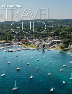
Petoskey Area - Northern Michigan Northern Michigan
Petoskey Area - Northern Michigan
Northern MichiganWelcome to the Petoskey Area - the Land of More and the epitome of Summer in Northern Michigan. Request this Free Visitor GuideRequested!You're all set! Request a few more Visitor Guides, or complete the form below to receive your guides by mail.
We also have visitor guides available in states highlighted in blue below. Click on any state to see what's available.
Alaska
Arizona
California
Canada
Colorado
Hawaii
Idaho
Louisiana
Michigan
Montana
Nevada
New Mexico
Ohio
Oregon
Texas
Utah
Washington
Wyoming
Switch to Mobile Browser Mode
We offer a compact version of Go-Michigan for mobile users, allowing you to access just the information you need on the road. Of course, you can still use the full version of Go-Michigan on your mobile device just as you can on your desktop.